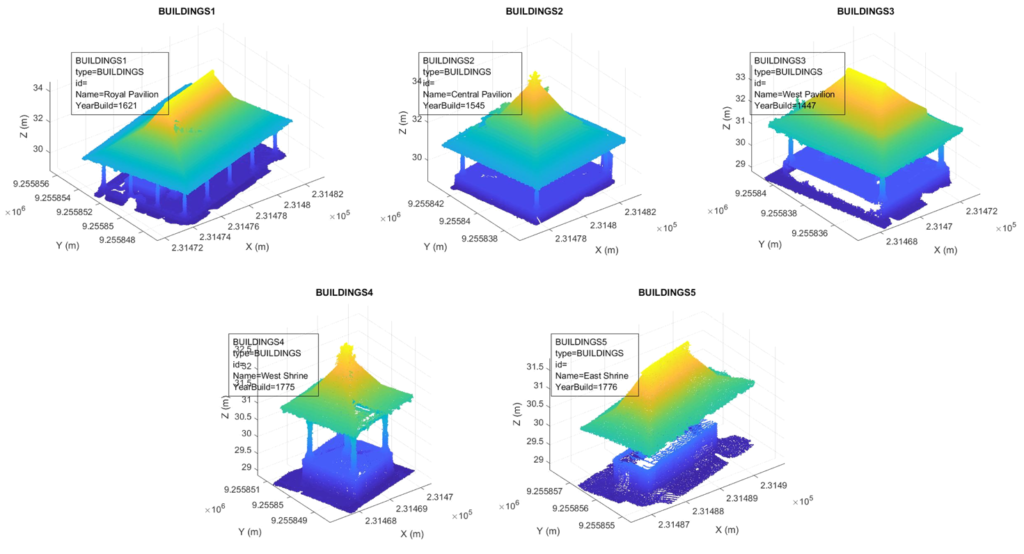
The documentation of built heritage has seen a significant development these past few decades due to advancements in new 3D sensors and 3D recording techniques. 3D data serve as reliable and tangible archive for historical sites and monuments. Since 3D data have such importance in the field of heritage documentation, quality control is paramount and must be performed before any point cloud processing is even planned to be conducted. The thesis is therefore divided into two parts. The first part concerned mainly the data acquisition and quality control of the point cloud data using the two techniques most commonly used, i.e. photogrammetry and laser scanning. A particular emphasis was also put on the integration of photogrammetry and laser scanning within the context of a multi-scalar documentation of a heritage site. The second part will address the processing of the resulting point cloud, particularly its segmentation and classification. The multi-scalar approach proposed in this thesis is an important point to note, as in many cases a historical building of interest is located in a historical neighbourhood; thus the requirement for a multi-scalar segmentation. By combining these two parts, the thesis had attempted to address the 3D workflow of heritage sites in a holistic manner, from the 3D data acquisition up to the resulting point clouds’ segmentation and classification into individual entities in various scale steps.


PhD Candidate
Arnadi Murtiyoso
Date of Defence
9 July 2020
Jury Members
- Pierre Charbonnier (President of the jury, Examinator)
- Pierre Grussenmeyer (Thesis director)
- Diego Gonzalez-Aguilera (Reviewer 1)
- Andreas Georgopoulos (Reviewer 2)
- Fabio Remondino (Examinator)
Related Publications
Murtiyoso, A. ; Grussenmeyer, P. 2020. “Virtual Disassembling of Historical Edifices: 3D Pipeline Automation for Large Point Cloud Classification”. Article soumis à la revue Sensors. https://doi.org/10.3390/s20082161
Murtiyoso, A.; Grussenmeyer, P.; Suwardhi, D.; Awalludin, R. 2018. “Multi-Scale and Multi-Sensor 3D Documentation of Heritage Complexes in Urban Areas”. ISPRS International Journal of Geo-Information, 7, 483. https://doi.org/10.3390/ijgi7120483
Murtiyoso, A.; Grussenmeyer, P.; Börlin, N.; Vandermeerschen, J.; Freville, T. 2018. “Open Source and Independent Methods for Bundle Adjustment Assessment in Close-Range UAV Photogrammetry”. Drones, Volume 2, Issue 1, 3. https://doi:10.3390/drones2010003
Murtiyoso, A.; Grussenmeyer, P.; Suwardhi, D. 2019. “Technical Considerations in Low-Cost Heritage Documentation”. The International Archives of the Photogrammetry, Remote Sensing and Spatial Information Sciences, Volume XLII-2/W17. pp. 225-232. https://doi:10.5194/isprs-archives-XLII-2-W17-225-2019
Murtiyoso, A.; Grussenmeyer, P. 2019. “Automatic heritage building point cloud segmentation and classification using geometrical rules”. The International Archives of the Photogrammetry, Remote Sensing and Spatial Information Sciences, Volume XLII-2/W15. pp. 821-827. https://doi: 10.5194/isprs-archives-XLII-2-W15-821-2019
Murtiyoso, A.; Grussenmeyer, P.; Suwardhi, D.; Fadilah, W.A.; Permana, H.A.; Wicaksono, D. 2019. “Multi-sensor 3D recording pipeline for the documentation of Javanese temples”. The International Archives of the Photogrammetry, Remote Sensing and Spatial Information Sciences, Volume XLII-2/W15. pp. 829-834. https://doi: 10.5194/isprs-archives-XLII-2-W15-829-2019
Murtiyoso, A.; Grussenmeyer, P. 2019. “Point cloud segmentation and semantic annotation aided by GIS data for heritage complexes”. The International Archives of the Photogrammetry, Remote Sensing and Spatial Information Sciences, Volume XLII-2/W9. pp. 523-528. https://doi:10.5194/isprs-archives-XLII-2-W9-523-2019
Murtiyoso, A.; Grussenmeyer, P.; Suwardhi, D.; Sumantri, D.; Wahyu, S.; Purnama, I.; Murtiyoso, S.; Andryana, G.; Awalludin, R. 2018. “Digital Documentation Workflow and Challenges for Tropical Vernacular Architecture in the Case of the Kasepuhan Palace in Cirebon, Indonesia”. 2018 3rd Digital Heritage International Congress (DigitalHERITAGE) held jointly with 2018 24th International Conference on Virtual Systems & Multimedia (VSMM 2018). https://doi: 10.1109/DigitalHeritage.2018.8810090
Murtiyoso, A.; Grussenmeyer, P. 2018. “Comparison and Assessment of 3D Registration and Georeferencing Approaches for Exterior and Interior Point Clouds in the Case of Heritage Building Recording”. The International Archives of the Photogrammetry, Remote Sensing and Spatial Information Sciences, Volume XLII-2. pp. 745-751. https://doi:10.5194/isprs-archives-XLII-2-745-2018
Murtiyoso, A.; Grussenmeyer, P.; Börlin, N. 2017. “Reprocessing Close Range Terrestrial and UAV Photogrammetric Projects with the DBAT Toolbox for Independent Verification and Quality Control”. The International Archives of the Photogrammetry, Remote Sensing and Spatial Information Sciences, Volume XLII-2/W8. pp. 171-177. https://doi:10.5194/isprs-archives-XLII-2-W8-171-2017
Funding and Duration
This PhD thesis was financed by a grant from the Indonesian Endowment Fund for Education (LPDP), Republic of Indonesia. All work and publications related to this dissertation was conducted within the period of April 2017 to June 2020 in the TRIO group of the ICube Laboratory at INSA Strasbourg, France.
Access
The PhD dissertation manuscript can be downloaded here.
